Our friend Henry Laurent Had already arrived 3rd in compensated time at the first stage in Madeira in the solo performance category. Author on February 1 of an excellent departure from Funchal for the second stage, aboard his faithful heating choir 3 (Sunfast 3200), Unfortunately, he has undergone some harmful damage throughout his career. Diesel leakage, repeated pilot breakdowns, Rupture of Genoese Drisse, among others, made him lose several hours and a packet of nautical miles. Read more …
Label : SailGrib
SailGrib renews its GRIB model offering
![]() The latest version of SailGrib WR arrives with a completely revised list of weather and ocean models in order to allow users to benefit from the evolution of the offer of international forecast models. The number of models offered increases with new models and the addition of new resolutions available for certain models). Some models evolve and others are added. The version beta is already online. Read more …
The latest version of SailGrib WR arrives with a completely revised list of weather and ocean models in order to allow users to benefit from the evolution of the offer of international forecast models. The number of models offered increases with new models and the addition of new resolutions available for certain models). Some models evolve and others are added. The version beta is already online. Read more …
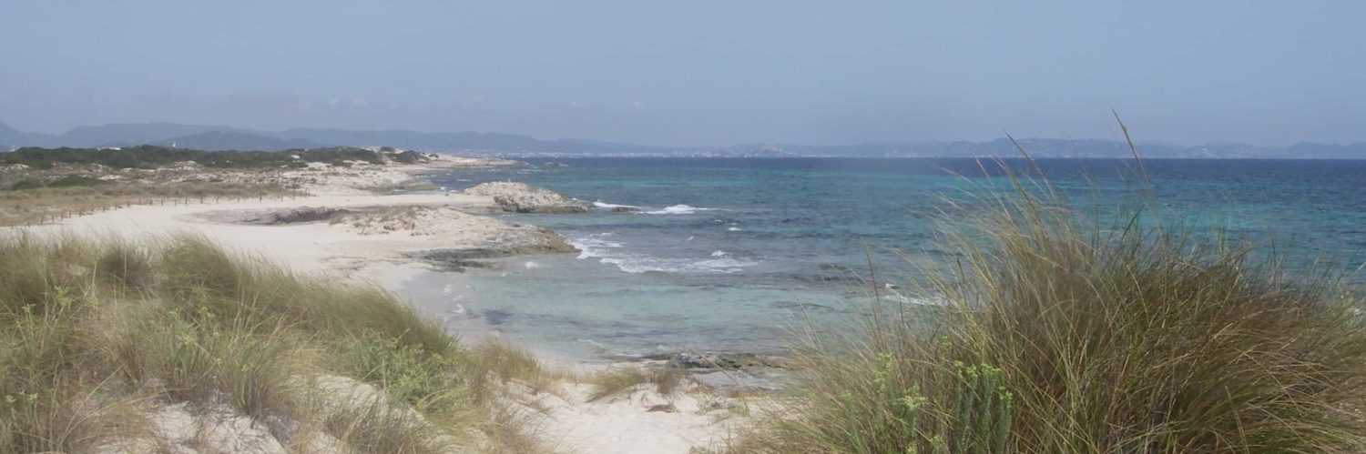
Sargassum, North Atlantic calamity
 Sargassum (sargassum) are brown algae that grow in the Sargasso Sea, off the coast of Florida and the Bahamas, where they get their name from. Some floating species then drift in a long belt that sometimes extends for thousands of kilometers on the surface of the sea depending on ocean currents and winds..
Until 2010 they developed mainly in their region of origin, the Sargasso Sea. In 2011, for a reason probably linked to human pollution, but not only, the Sargasso Sea overflowed. Sargassum formed a second sea in the ITCZ (Intertropical Convergence Zone) in the north of Brazil. Read more …
SHOM removes facsimiles from UK charts
With the latest update of the SHOM charts portfolio 16 th, 2021, Geogarage announces the removal of 18 facsimile charts from British charts covering, mainly, the south coast of England and Gibraltar. These areas are now only covered by the British Admiralty portfolio. (You are there).
Indeed, SHOM recently announced (¹) the rationalization of its catalog of nautical charts, onwards September 2021, by the deletion of many foreign charts reproduced under historical reciprocity agreements with some foreign hydrographic services. Read more …
Navygatio : SailGrib’s “Cloud” service

The latest update V.6.4 of SailGrib WR brings a major novelty : Navygatio (¹), a web interface which will allow navigation to be recorded on a server as it happens, to add pictures, to share your page with loved ones, to compare the traces, to analyze performance, and many more things to come. A real “ cloud »at the unique service of SailGrib WR users on Android and Weather4D Routage & Navigation users with iOS. Read more …
SailGrib WR adopts Geogarage maps

Collaboration is progressing between SailGrib and Weather4D. The recent version SailGrib WR 6.0 adds support for platform maps Geogarage including the international catalogs of SHOM and UKHO from around twenty publishers. These “tiled” raster maps are mainly based on digital data from official hydrographic services., or more than 10.000 maps available today, and viewable on their interactive catalog.
Unlike the majority of private providers, Geogarage offers subscriptions by publisher, and not by geographical area (¹). These are renewable annual subscriptions allowing regular updates. The icing on the cake is the pooling of subscriptions between Android and iOS devices : an account created on the Geogarage platform allows you to download subscribed maps to an iPad with Weather4D Routing & Navigation and an Android smartphone with SailGrib WR, or conversely an Android tablet and an iPhone with their respective application, up to five different devices. Read more …
SailGrib VR – Dedicated routing for Virtual Regatta
![]() The brand new SailGrib application is available on the Google Play. SailGrib pour Virtual Regatta is solely dedicated to gaming. It brings the power of SailGrib routing optimized for Virtual Regatta enthusiasts while retaining the ergonomic and popular interface of other SailGrib applications..
The brand new SailGrib application is available on the Google Play. SailGrib pour Virtual Regatta is solely dedicated to gaming. It brings the power of SailGrib routing optimized for Virtual Regatta enthusiasts while retaining the ergonomic and popular interface of other SailGrib applications..
By opening the application, once your Virtual Regatta credentials have been entered, you are then instantly connected to your account. By default the application opens on the last connected race. If you have other races in progress, you select them in the side menu (navigation drawer).

Position and track of the boat displayed in real time
Without any manipulation or adjustment, find your position displayed in real time on the planisphere. If a new weather file is available for the game, it will be automatically downloaded when opened. This is the same 1° GFS model that is used in the game. Read more …
Routing : from game to reality
On the second day of racing of this Vendée Globe 2020, we can say that the weather conditions that the skippers will experience on the descent towards the Doldrums will be particularly tough. After leaving in lousy weather, a first not very active cold front passed without incident, the loners will cross a second, much more violent front during the night and morning from Tuesday to Wednesday, for the group going to the West, and in the evening for the group passed between the DST (¹) and la in French.
But these future conditions are very different for Virtual Regatta players and for sailors… Read more …
SailGrib sets sail for the Vendée Globe 2020
Non, it's not a joke ! SailGrib embark with Weather4D on the Vendée Globe 2020 with Virtual Regatta. The two friends Henri and Olivier have together developed a routing module directly integrated into the game.
Philippe Guigné, the creator of the online game Virtual Regatta, explains in an interview with Sails & Sailboats :
«… we want the virtual Vendée Globe to be aimed at the general public and it is therefore logical that we help newbies by providing new tools. So, For this edition we are offering a routing assistance system, directly integrated into the game, in partnership with SailGrib and Weather4D. These routings will first be simplified so that everyone can use them. In a second step, we will put in place more elaborate routings which will allow us to determine long-term strategies…"
A new development for the two leaders in navigation applications, weather and routing on mobile devices, which should allow them to popularize their applications to a wide audience, and perhaps trigger vocations among the large number of players who have never set foot on the water.
SailGrib maximizes the weather display
In his latest newsletter dated 14 th January, SailGrib explains the improvements in weather display by overlaying satellite imagery and isobaric maps, called “frontology”.
