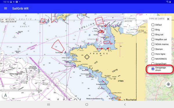
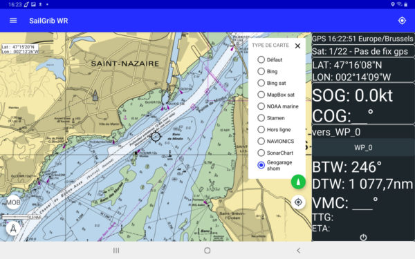
Collaboration is progressing between SailGrib et Weather4D. The recent version SailGrib WR 6.0 adds support for platform maps Geogarage including the international catalogs of SHOM and UKHO from around twenty publishers. These “tiled” raster maps are mainly based on digital data from official hydrographic services., or more than 10.000 maps available today, and viewable on their interactive catalog.
Unlike the majority of private providers, Geogarage offers subscriptions by publisher, and not by geographical area (¹). These are renewable annual subscriptions allowing regular updates. The icing on the cake is the pooling of subscriptions between Android and iOS devices : an account created on the Geogarage platform allows you to download subscribed maps to an iPad with Weather4D Routing & Navigation and an Android smartphone with SailGrib WR, or conversely an Android tablet and an iPhone with their respective application, up to five different devices.
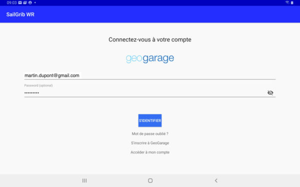
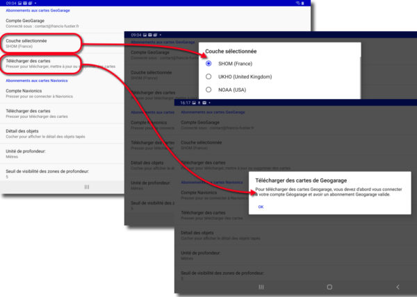
In the menu Preferences of SailGrib WR we implement the subscriptions taken out in the section Cards. We first connect to the Geogarage account with the identifiers created when subscribing to the platform.
Once the connection is established, we select one of the subscribed files, which allows you to download the desired areas. In fact, the cards are displayed instantly via the internet connection., but downloading is essential to keep the maps offline.
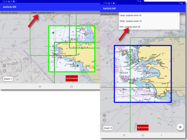
The download takes place according to three levels of detail : Large = road and crossing maps, zoom level 10, Coastal = coastal maps, zoom level 15, Port = detailed maps of ports and anchorages, zoom level 20. We drag the map under the predefined frames and start the download, for every desired level of detail, and we reproduce the operation for each part of the geographical area to be covered.
The download procedure is fortunately quite fast thanks to an effective compression mechanism for the downloaded tiles.. This is excellent news for SailGrib users who want to find the quality of official maps as an alternative to Navionics maps which are quite cumbersome to manage., especially for updates.
–––
(¹) With the exception of the private publisher Imray
–––


Awesome !
Just a little expensive…
When will Shom disseminate data in open data as in the United States? ?
We must put things into perspective : 60 € for more 1400 cards this is the price of two paper cards ! As for open data in Europe, it's progressing with small, measured steps.