SHOM removes facsimiles from UK charts

With the latest update of the SHOM charts portfolio 16 September, 2021, Geogarage announces the removal of 18 facsimile charts from British charts covering, mainly, the south coast of England and Gibraltar. These areas are now only covered by the British Admiralty portfolio. (UKHO).

Indeed, SHOM recently announced (¹) rationalization of its catalog of nautical charts, onwards September 2021, by the deletion of many foreign charts reproduced under historical reciprocity agreements with some foreign hydrographic services. Read more …

Navygatio : SailGrib's "Cloud" service

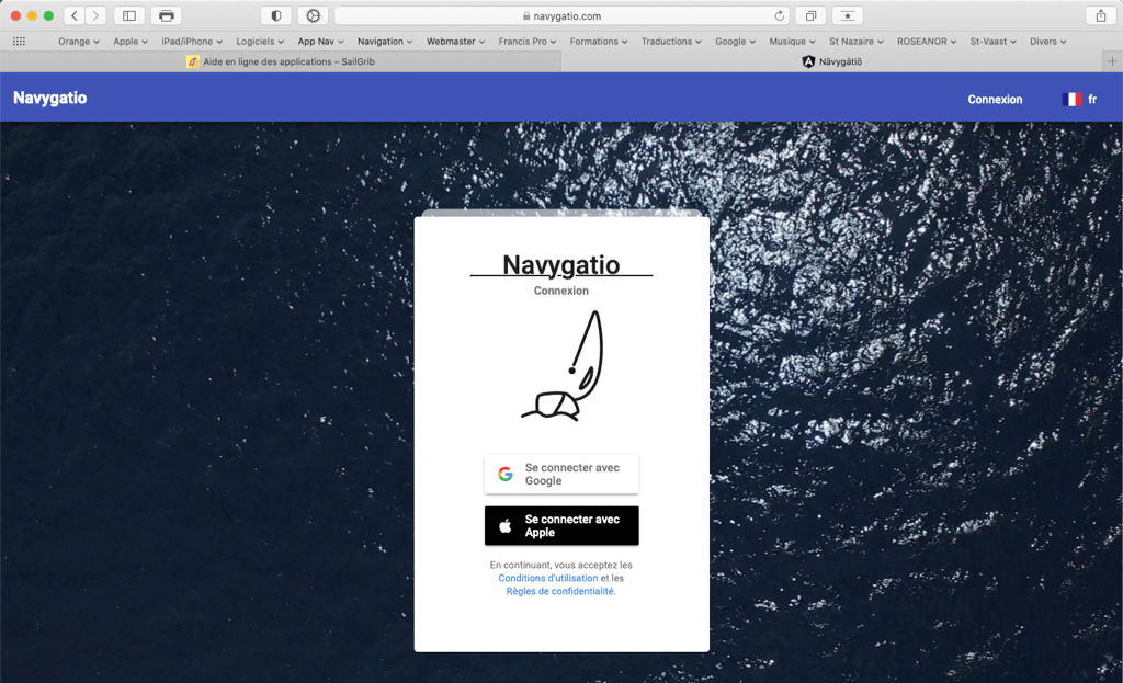
The latest V.6.4 update of SailGrib WR brings a major novelty : Navygatio (¹), a web interface that will allow browsing to be recorded on a server over the water, to add pictures, to share his page with relatives, to compare the tracks, to analyze performance, and many more to come. A real " cloud »at the unique service of SailGrib WR users on Android and Weather4D Routage & Navigation users with iOS. Read more …

You said "Medicane" ?

The many sailors who crisscross the "Big Blue" have known for ages that, if the navigation is relatively easy, meteorology represents a particularly difficult constraint to apprehend. Indeed, if the coasts are mostly steep and the dangers very localized, if the tides are almost negligible, if the currents are only to be taken into account in well-defined areas, the major difficulty comes from a capricious meteorology, difficult to predict, can represent a real danger by his changing moods, sudden, even brutal. Read more …

Introduction to Marine Weather [2021]

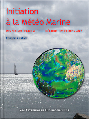
The new tutorial " Introduction to Marine Weather »Is available on the Amazon Store for e-reader and cross-platform applications Kindle.

Complete overhaul of the work initially published in 2015, new layout, clearer and more readable in portrait mode, complete revision of the text, updated videos and illustrations.

From basic knowledge to interpreting GRIB files, an educational path to help better understand the weather, the one he will do, and master the weather-routing and navigation applications, like SailGrib, Weather4D, and many others.

  • 130 pages
  • 15 videos
  • 100 illustrations

This work replaces the previous deleted.

[Update 10 more 2021] Update V.1.3 online at Amazon.co.uk. Video correction and links.

SailGrib WR adopts Geogarage maps

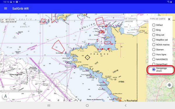
Collaboration is progressing between SailGrib and Weather4D. The recent version SailGrib WR 6.0 adds platform map support Geogarage including the international catalogs of SHOM and UKHO among around twenty publishers. These “tiled” raster maps are mostly based on digital data from official hydrographic services., be more than 10.000 maps available to date, and available on their interactive catalog.

Unlike the majority of private providers, Geogarage offers subscriptions by publisher, and not by geographic area (¹). These are renewable annual subscriptions allowing regular updates. The icing on the cake is pooling of subscriptions between Android and iOS devices : an account created on the Geogarage platform allows you to download the subscribed maps on an iPad with Weather4D Routing & Navigation and an Android smartphone with SailGrib WR, or conversely an Android tablet and an iPhone with their respective application, up to five different devices. Read more …

SailGrib VR – Dedicated routing for Virtual Regatta

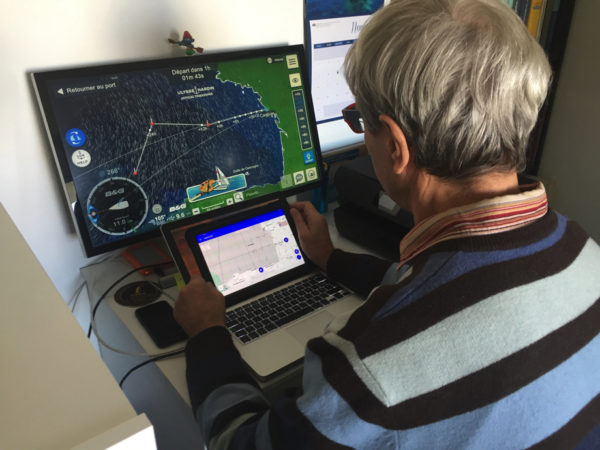
The brand new SailGrib app is available on the Google Play. SailGrib for Virtual Regatta is only dedicated to the game. It brings the power of SailGrib routing optimized for Virtual Regatta enthusiasts while retaining the ergonomic interface and appreciated by other SailGrib applications.

By opening the application, once your Virtual Regatta credentials have been entered, you are therefore instantly logged into your account. By default, the application opens on the last connected race. If you have other races in progress, you select them in the side menu (navigation drawer).

Position et trace du bateau affichés en temps réel

Position and track of the boat displayed in real time

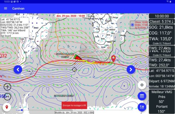
Without any manipulation or adjustment, find your position displayed in real time on the planisphere. If a new weather file is available for the game, it will be automatically downloaded when opened. The same 1 ° GFS model is used in the game. Read more …

Routing : from game to reality (Continue)

Friday 13 November will not be a lucky day for the Vendée Globe skippers 2020 (¹). They will have to negotiate the meeting with the tropical storm "Theta" which crosses their course with average winds which can reach the 40 knots and strong gusts. Especially the sea will be to fear because, strongly crossed when passing the low pressure center, the waves may exceed the 6 meters and surge chaotically. Read more …

Routing : from game to reality

On the second day of racing in this Vendée Globe 2020, we can say that the weather conditions that the skippers will experience on the descent to the Doldrums will be particularly tough. After a departure by a young lady, a first not very active cold front which passed without a hitch, the loners will cross a second much more violent front in the night and morning from Tuesday to Wednesday, for the group going to the West, and in the evening for the group spent between the DST (¹) la France.

But these conditions to come are very different for Virtual Regatta players and for sailors.… Read more …

Android Marine embarks for the Vendée Globe 2020

eh yes, everything happens ! In my entire IT-nautical career I had never played any game on a computer, not even the historic Windows card game that cost businesses thousands of idle office hours… but you should never say : never !

Or donc, here I am registered at Virtual Regatta, one among the more than 340.000 players registered at this time, ready to start the Vendée Globe tomorrow at 1:02 p.m.. Like any beginner, I watched some videos to quickly understand this game, who, are all, seems relatively simple for a confirmed sailor. But from there to playing with the big boys, there are still several oceans to cross !

Read more …

GNS 3000 Bluetooth GPS receiver for mobiles

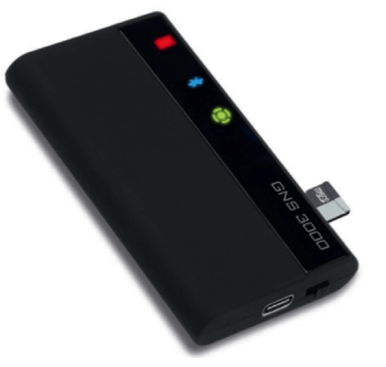
New GNS 3000 announced by Global Navigation Systems since last spring is finally available (¹). It replaces the GNS 2000 Plus. Now equipped with a Bluetooth transmitter 5.0, it has an SD Card slot for recording position data continuously.

Compatible with android products, it is mainly intended for devices without a built-in GPS. It can be used with all PDAs, Bluetooth enabled laptops and tablets. It has a Li-Ion battery offering an autonomy of 10 continuous hours. Read more …