At the time of launch this new blog, an inventory of applications readily available on Android platforms is required. This allows today to describe the existing as a starting point and will evaluate in the future path of the future developments.
The terms "marine applications" I want essentially indicate navigation applications meet the needs of boaters browsers browsing starting the coast of France to all potential destinations of the world. I will eliminate all of my inventory those intended for use only mapping NOAA (¹) to U.S. shores, and those which do not cover mapping supported the coast of France. It is clear that the inventory will be fast.
The browser needs a perfect electronic mapping supported by an application that continually meet three key issues : where it is (s position), during which the go (the road), what are the dangers around him. So a tool capable of reproducing real-time and effortlessly it would - or was once - laboriously on an official map of a water service with a compass, a bearing compass, a dividers, a navigation rule, a pencil drawing, and a gum… many method. In addition, thanks to modern mobile devices connected to the Internet, the browser can now get continuously forecast its future course. Here is, Android, applications that can meet the above-mentioned criteria :
Mapping Applications
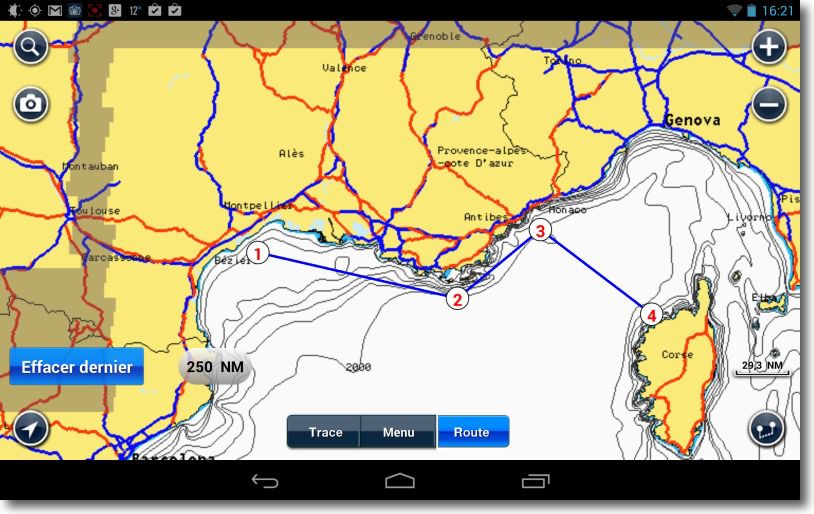
 • Navionics Marine : The first application of vector mapping developed on the iOS release of the iPhone 3GS end 2008 has been ported to Android 2010. Rates have often increased since then on both systems, and cutting areas is very different from that proposed for cards Gold and Premium. The big disappointment Navionics Europe Android is the lack of options Nav Module, Persian Letters and Autorouting, and the recent option Navionics (²) available on iOS. We therefore have the basic version appeared after "Navionics Viewer" on iPhone 2008. Without Nav Module, impossible to create routes and activate the GoTo, and then have a free tray information on travel times and distances. One can certainly create more routes waypoints, but not follow. Only see the position and track of the boat. In addition, the database information (POIs) is much less provided (³). Therefore this application is only useful in small coastal navigation to browse through Andalusia to the Urals !
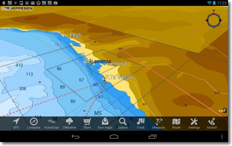
 • Plan2Nav : the great Italian rival Navionics, C-Map, bought by the U.S. Jeppesen, offers since late 2011 its application of free navigation. The pretty vector mapping C-Map can be bought online as desired regions and covers virtually the entire world. Identical to the iOS version, she used to satisfy this designer on the GPS and plotters market boating. Vue 2D perspective, Manual rotation of the card, driving up, waypoints, roads and GoTo function, recorded track, weather forecast 5 days (but display more than summary), tides and currents (to check the quality), the application has the required minimum. Absence also file export / import functions.
A user support is available as a PDF download on the publisher's website.
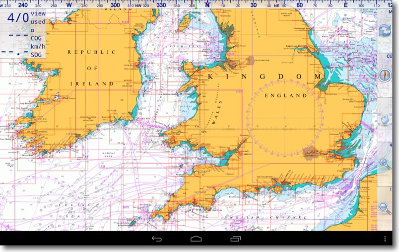
 • Marine Navigator : A dedicated application in the German raster mapping of all kinds : NOAA RNCs du, BSB / KAP, MNX, OpenSeaMap and others. Although I find the raster maps poorly adapted to mobile devices, we find a large number of internet download, links are provided by the developer, but I'm not sure I found maps for the coast of France. At the user to decide the level of quality of the cards he wishes to use. The list of features is impressive, but only available in paid version :
- Automatic change map with the zoom level and / or the progress of the boat
- Scroll cards available for the position by holding down the zoom button
- Display card limits available
- Orientation True North or real road map
- Traces, waypoints and routes
- Automatic tracking of the road
- Import / export of waypoints and routes GPX
- Exporting from GPX tracks
- Compas (Magnetic or true heading, True North indicator)
- Dashboard data
- Man according to the sea
- Import and registration cards in external files
- Support encrypted cards
Besides the fact that the raster mapping to be very large, and difficult to find – Update – for Europe, the application does not shine by its friendliness.
 Applications Marine Weather
Forecasts of marine weather, the number of applications is also limited. Meanwhile Weather4D, he must be content with the following two, well known browsers. As in both cases, no information or data without connecting to the Internet via WiFi or 3G.
 • Consult Marine Weather : identical to the version for iOS, this application provides very detailed to the smallest spot wide open for a major part of Europe west coast data. Some data are streamed, so you need a receipt with a good flow. Forecasts are displayed by successive data, can not superimpose. It is not GRIB data, only textual and graphical forecasts, complete for inshore navigation. On my tablet excellent definition, videos are a more than mediocre, it's a shame.
 • Météo France : The new presentation of this application unfortunately does not give a proud image of public service. Intrusive advertising is covered repeatedly applying, this is pathetic. Funded by our taxes, this organization could do without the pub, or make it a little more discreet, and propose an application at least the level of Meteo Consult. But it is likely that the group means are above the BBC allocated by the ministry budget Weather France. The only interest of this application lies in providing (going back a page of advertising) bulletins in text format of Sailing and Sea Interservice, for Grand Large areas METAREA 2 and 3, Large areas and Coast, Specials Newsletters.
As long as these remain only a few applications available on Android, there is little chance that browsers are seduced. But many allergic to apple should call their wishes known developers in the nautical field so they have the courage to bring their applications in this environment.
—
(¹) See this acronym in Glossary.
(²) See article Navionics Marine louder Navigation on the Mac blog.
(³) Note that I've tested on Nexus Tablet 7 V2 with Android 4.3.
—


Et windguru?
Windguru is an excellent project, present on the internet and on many platforms, dont Android. But his predictions are primarily intended for use coastline, established for spots where practice surfing activities, windsurfing, kite surf, etc.. If the data are based on models of marine weather, they are of little use in maritime navigation, whether coastal or offshore. Windguru is not within the scope of my remarks that caters only to shipping.
I use Marine Navigator and Androzic (free) with maps Shom. Both applications are roughly equivalent and rather successful. You can import waypoints and routes plotted in Open CPN. This is very useful as an adjunct to the PC chart table.
For coastal regatta, windfinder provides forecasts quite satisfactory in most cases.
Maps SHOM ? but what cards, you find where ?
Effectively, le SHOM a conçu 9 CD 1998 up to 2002 editor for Fugawi. Quality raster maps excellent. But the orientation ENC ended this production. This is unfortunate. NOAA in the U.S. and in England UKHO always produce raster maps.
There a few years, SHOM has fulfilled its public service mission and marketed ENC CD for a very small fee… It is obvious that these maps are outdated and is no longer possible to get them.
Hello
For mapping purposes Plan2Nav CMAP is it the same as PC applications such qu'ADRENA ?
If yes, Is used for each software or application running with this mapping ?
Thank you .
Not, incompatible. Plan2Nav CMAP = 4D, Adrena = CMAP NT and MAX.
Comment for plan2nav "As for iOS no help is integrated, and no online support explains the operation of the application. You have to guess everything and some manipulations are far from obvious "
There is still a "user guide" download pdf , Although highly simplified but very useful, available on page
http://ww1.jeppesen.com/marine/lightmarine/mobile-devices-charts.jsp
Thank you for this information, I had not seen appear on the site Jeppesen. I corrected the text.
Hello,
You forget Scannav companion who also uses raster maps and is in French.
The documentation can be found here :
http://www.scannav.com/Compagnon/DocSNCompagnon.pdf
I'm trying to test.
A follow
Daniel
Despite all the good I think of Marc Lombard, it is premature to speak of a beta test version not yet marketed. A little patience.