 After the publication of my previous article on navigation applications, Henri Laurent contacted me to correct the omission of his SailGrib WR application, unfortunately slipped through the meshes of my first research. SailGrib and SailGrib WR have been on Google Play since the beginning 2013.
These two applications are based on queries and the display of GRIB files, the WR version adds a routing module.
GRIB Files
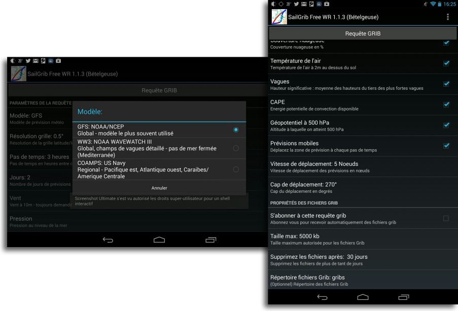
Queries are executed via messaging on the Saildocs server. Files received as attachments in the mailbox can only be opened in SailGrib by using a dedicated application, like Download All Files that must be installed beforehand. Unfortunately it doesn't always work very well, and I didn't try to replace it with a less versatile application. The GRIB models are only the GFS for Europe and the World and the COAMPS for the USA. The model WW3 is also supported for waves (¹).
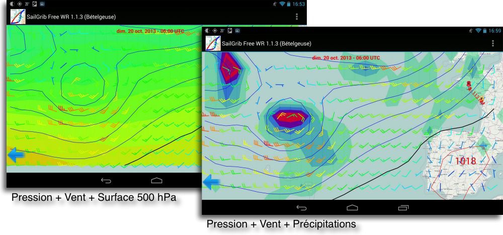
In addition to the choice of available data to select for these models, Some criteria are welcome, such as moving forecasts by moving the area at each time step, based on a fixed average speed and heading, Subscription to GRIB for automatic receptions, or the choice of a maximum size of the required files. The display allows the superimposition of several data, but care must be taken not to put too much of it, otherwise it will be difficult to read.
The display is rather rudimentary, without the possibility of adjusting the texture or transparency of the different data layers. The absence of pressure labels on each isobaric is to be regretted, and the choice of representation of cloud cover is rather inconvenient to read. But overall, the reading remains clear enough to assess the evolution of the forecasts.
Routing
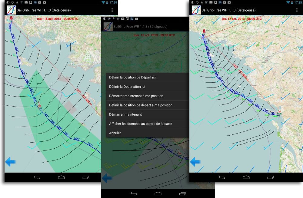
As for the processing of GRIB files, We find good and not so good. On the plus side, routing is based on a large number of criteria and settings, some of which come directly from user demand.
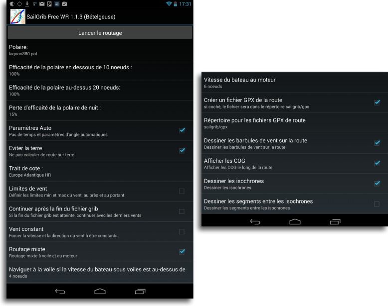 A large number of speed polars is provided in the app (I counted some 37) and a method is proposed by the developer to import others. Clever settings, such as the possibility of reducing the night fleece (The app manages the length of the night according to the position of the ship) and the setting of a maximum upwind angle for the comfort of the crew. Or the mixed sail and engine routing, which allows you to define below what speed the sailboat will sail with the engine, and how fast it will move with the engine.
Without having been able to compare the calculated routing with reference applications, as Adrena, Weather4D PRO or MaxSea to judge its effectiveness, this module remains limited to this day by the GFS model used, at least for Europe. With a minimum mesh size of 0.5°, either 30 nautical miles in latitude, The calculations can only be relevant on roads with a minimum of 150 Miles. This is perfect for offshore courses in the 1 up to 3 days, or even more, such as crossings of the Bay of Biscay or the Mediterranean from Marseille to southern Corsica, in example, but will not be at all suitable for small coastal courses for which the data are scattered over a grid that is far too large, or very fast boats.
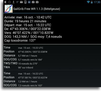
SailGrib WR automatically selects the pitch of the isochrones according to different criteria of the course, and once the optimized route has been calculated, a route table is provided with the data calculated on each portion of the route.
 SailGrib is therefore still a young application, with great features, but which will have to evolve in the technical aspects (fine-knit weather models) and ergonomics (Improved graphics processing) to pretend to compete with his elders. But for the moment, the problem does not yet arise on Android or SailGrib WR remains without real competition. Unless it escaped me once again !
—
(¹) See the definitions of weather models in the Glossary.
—


